Congratulations to
Alfonso, M. B.,
Vitale, A. J.,
Menendez, M. C.,
Perillo, V.L.,
Piccolo, M. C.
Perillo, G.M.E.
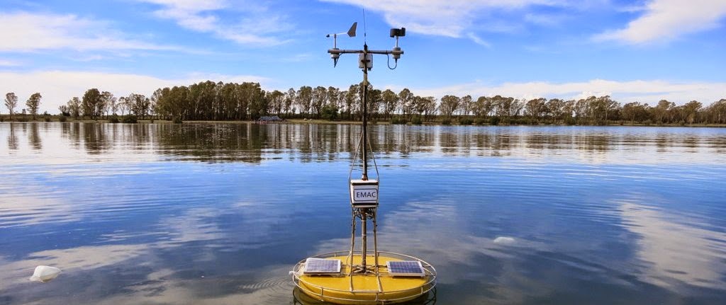
Article: ECOSYSTEM ESTIMATION OF OXYGEN METABOLISM FROM DIEL TECHNIQUE IN A SHALLOW LAKE SALINE: THE SALT (ARGENTINA) ".
has-been accepted for publication in Hydrobiologia
SAFER: Sensing the America´s Freshwater Ecosystem Risk from Climate Change
2014/10/21
2014/10/18
SAFER annual meeting
During November 1-3 there will be held the 3° SAFER annual meeting. It will take place in the Station de Biologie des Laurentides (Universté de Montreal (http://www.sbl.umontreal.ca/)
Hydrologic Modeling in the Watershed
This is a summary of the training course in Chile SAFER students, taught by Tom, Brian, Natalie and Beverley.


Hydrologic
Modeling in the Watershed
30 Apr –
3 May 2014
Instructors:
Tom
Harmon, University of California Merced (SWAT, HYDRUS and PIHM)
Natalia Hoyos, Corporación Geológica ARES, Colombia (ArcGIS
and SpatialAnalysis)
Brian
Reid, Centro CIEP (Ecosystem Services Models)
Beverley
Wemple, University of Vermont (ArcHydro and ArcGIS)
General Workshop Objective:
Develop skills in delineation and characterization of watershed attributes
(contributing area for lakes, wetlands, rivers, or other study system. Followed
by basic watershed processes and modeling of watershed hydrology. The
workshop will be conducted in the context of team-based problem solving, based
on the cohort of graduate students in project SAFER, and using SAFER sites as
case studies, or other student project sites.
Specific Objectives:
- Obtain
and develop spatial data sets for characterization of watershed
attributes: basin delineation, definition of stream network and discharge
points, extraction and calculation of watershed area and corresponding
geology/soils/vegetation cover. Familiarization with globally
available ASTER elevation models, spatial regression modeling (to model rainfall distribution as a
function of elevation).
- Introduction
to watershed modeling: theory, parameterization and execution of basic
watershed models (SWAT, HYDRUS, PIHM).
- Discussion/Literature
review of the linking of watershed attributes and the evaluation of
ecosystem services, or physical drivers of ecosystems.
Participants:
1.
Esteban Flores (Undergraduate, U de Concepcion)
2.
Hector Palacios (Undergraduate, U. de Concepcion)
3.
Alvaro Oniat (Masters, U. de Concepcion)
4.
Roxanna Ayllon (PhD Student, U Austral Valdivia)
5.
Dr. Anna Astorga (Paloma SiteCoordinator)
6.
Dr. Vanesa Perillo (PhD Candidate, U. Vermont)
7.
Facundo Scordo (PhD Candidate, IADO)
8.
Five Staff,
DGA Aysen (30 May only)
Resources:
6 computers, shared between two participants each. Participants are requested
to bring laptops with ESRI license where possible, however temporary 1 year
licenses will be available if needed. Exercises will be conducted in groups of
two, with students paired with DGA staff, initially focused on SAFER sites
(please arrive with coordinates for your sites, or send to the instructors in
advance, to facilitate download of Digital Elevation Data –DEM). Instruction
will be multilingual, with only half of the students with advanced English: facilitation
by Jorge Okuingttons, Anna Astorga, Roxanna Ayllon, Brian Reid and Natalia
Hoyos.
Data
and Model Portals:
SWAT/WEAP/PIHM etc.
https://eng.ucmerced.edu/snsjho/files/SAFER_Digital_Library/Graduate_Training_Program
https://eng.ucmerced.edu/snsjho/files/SAFER_Digital_Library/Graduate_Training_Program
ArcHydro(needed in addition to the 1
year ESRI instalation package)
Proposed
Sites:
(1)
Murta and
Ibanez basin (Esteban, Hector, Alvaro, Brian: more data available for more
advanced models, three participants working on their theses at this site).
(2)
Paloma
Lakes Complex (Anna, some work has already been done)
(3)
Valdivia
water supply (Roxanna)
(4)
Sengeur
basin, Argentina (Facundo)
Available
Data for Chile:
·
DEM:
ASTER 30m (what I have has been poorly transformed, lots of banding, need to
redo)
·
Hydrography:
detailed data digitized from topographic maps.
·
Climate:
BIOCLIM, DGA Catastro (20-30 yr summary of flow and meteorological data), and
grid of six stations supplementing the Murta/Ibanez watersheds.
·
Vegetation/Land
Use: detailed data with very high quality classification for the Aysen region
·
Soils:
Soil depth distribution (modeling or interpolation) may be possible based on
available raw data from 100+ sites in the region (B. Reid, S. Bertrand).
Agenda:
SPATIAL ANALYSIS using ArcGISand ArcHYDRO, 30 April, 1
May 2014
Beverley Wemple (University of Vermont, USA)
Natalia Hoyos (Corporación
Geológica ARES, Colombia)
UNIT 1(1/2 day)
1. Stream and watershed delineation
a.
DEM processing (fill,
flowdirection, flowaccumulation)
b.
Defining lake boundary
(extraction by attribute for the lake elevation, useful where lakes are large
and or poorly delineated)
c.
Delineating stream networks
d.
Delineating watershed
boundaries
e.
Define stream order
f.
Measuring flow length
2. Topographic metrics
a.
Slope
b.
Aspect
c.
Relief ratio
Exercise:
-
run hydro routines to delineate streams and watershed boundary for
example watershed
-
run slope grid and calculate mean slope and relief ratio (do for
several subwatersheds)
-
calculate flow length from sample sites
-
Brief discussion on contributing area for defining extents of stream
network
UNIT 2 (1/2 day)
3. Extracting features for watersheds/study areas
a.
Clip (for vector data)
b.
Mask (for raster data)
c.
Buffer (e.g. stream network)
d.
Identity / Intersect / Union??
Exercise –
-
grid combine to overlay watershed boundaries and landuse/landcover
to define for multiple watersheds
-
clip stream network for subwatershed
-
buffer high order streams and mask out landcover in stream corridor
4. Interpolation and spatial data modeling
a.
Kriging (with error estimate
maps)
b.
Regression-based spatial models
Exercise:
-
use extract values to determine elevation for precip
-
build regression-based model of precipitation distribution
Watershed Modeling and Ecosystem Services Evaluation, 2-3
May 2014
Thomas Harmon (University ofCalifornia, Merced, USA)
Brian Reid (Centro CIEP, UA Chile)
1.
Rainfall-runoff modeling concepts and model
structures (1/2 day)
2.
Model examples and tutorials (1
day)
a.
Water Evaluation and Planning
System (WEAP)
b.
HYDRUS-2D
c.
Penn State Integrated Hydrology
Model (PIHM)
Exercises and
demos:
-
Review of model structure
-
Model domain pre-processing
-
Model input files (meteorology)
-
Calibration and model validation
-
Model output post-processing (using R or Matlab scripts)
3.
Ecosystem Services Valuation
and Integration of Watershed Models (1/2 day)
Discussion items:
-
Review of ecosystem service types
-
ES model structures
-
Incorporating water and hydrologic processes in ES models
-
Evaluating climate change impacts using ES models
4.
One-on-one work sessions on
model test cases (1.5 day)
Model case studies:
-
Detailed instruction on the use of Hydrus-1D for assessing soil
hydraulics
-
Developing input files for meteorological variables
-
Constraining soil hydraulic parameters using Hydrus-1D soils library
-
Parameter identification schemes for soil hydraulic parameters
-
Application of Hydrus-1D to CIEP experimental sites
Allocation
of time for course
·
Preparation:
including reading assigned papers: 2-3 days
·
Theory
and Applications: 4 days @ 8 hours per day
·
Independent
assignments and practice sessions: as needed, typically 3-4 hours per evening
over 4 days
Suscribirse a:
Entradas (Atom)